


services
Interactive map interfaces
The containerized, autoscaling architecture ensures responsive performance across multiple concurrent users while supporting both connected and disconnected operational modes for field applications. Integration with GeoServer clustering provides robust map service delivery for complex railway networks


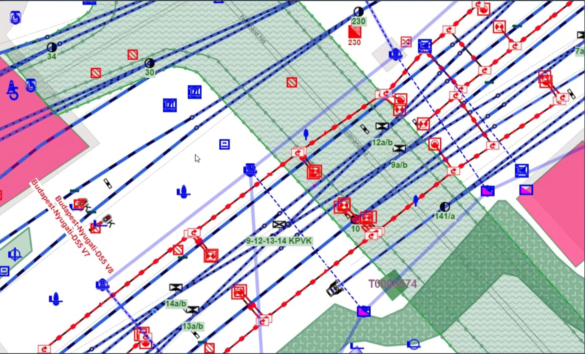
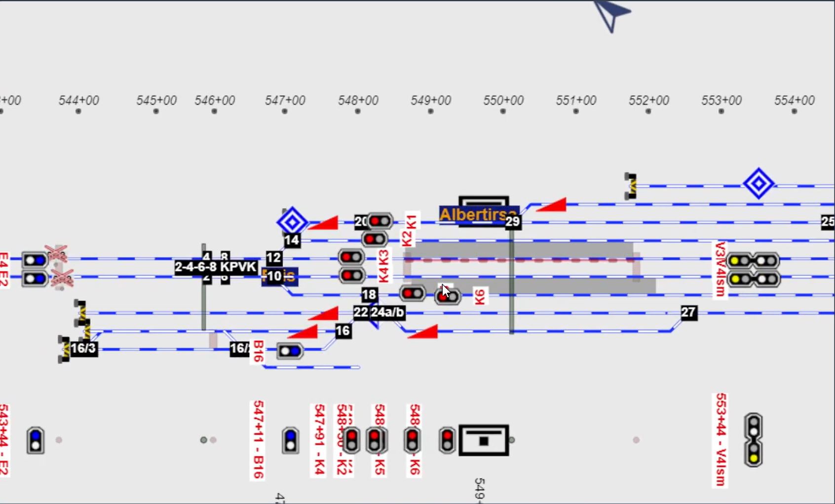
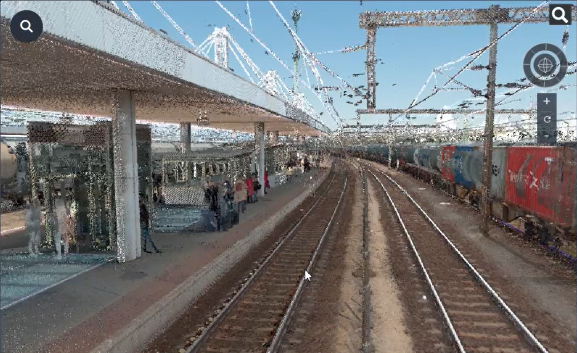
Our GIS solutions feature four distinct visualization methods designed to provide comprehensive perspectives on railway infrastructure:
- Map View: Map based presentation of the features. Selecting, editing, grouping of features.
- Point Cloud View: Processed coloured point cloud from LIDAR-based survey.Georeferenced storage to support planning tasks.
- Rail View: Showing panoramic images, collected during survey. Georeferenced storage to support planning tasks
- Graph-Based View: Automaticcaly generated logical topology based on physical infrastructure. Traffic-based logival topology with additiona information for itinerary book.
Partners & Collaborations

#1 Pothole detection
SFWLab developed an advanced real-time pothole detection solution to enhance road network infrastructure assessment using computer vision technology. The system employs camera sensor mounted on long-distance buses, enabling automatic detection of potholes while in motion. EDGE computing based real-time analysis allows immediate georeferenced logging of detected potholes, streamlining reporting fo...
#2 Case Study
We’re working on it!
Our Projects